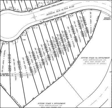
Subdivision Planning, Design and Surveying
N.E. Parrott Surveys Limited (NEPSL) provides comprehensive planning, design, engineering, and surveying services for residential, commercial, and industrial subdivision developments throughout Newfoundland and Labrador.
Our involvement can begin during the earliest conceptual stage and continue through detailed design, regulatory approval, construction layout, infrastructure verification, final surveying, and land registration. This integrated approach allows NEPSL to develop practical subdivision designs while ensuring accurate field layout, regulatory compliance, and coordinated project deliverables.
Key Services Include:
· Preliminary Planning and Site Assessment: Review of existing site conditions, topography, property boundaries, access, surrounding development, servicing options, drainage considerations, and regulatory requirements.
· Conceptual Subdivision Design: Development of preliminary subdivision concepts showing proposed lot configuration, road networks, access points, open spaces, infrastructure corridors, and the efficient use of developable land.
· Detailed Subdivision Design: Preparation of detailed plans that establish lot dimensions, road alignments, elevations, grading, drainage, municipal servicing, and other development requirements.
· Lot Configuration and Optimization: Design of practical lot layouts that consider the intended land use, zoning requirements, building areas, access, servicing, drainage, and marketability of the completed lots.
· Road and Access Design: Planning and design of subdivision roads, intersections, entrances, alignments, profiles, curbing, and associated access infrastructure.
· Water and Sewer Design: Planning and design support for municipal water lines, hydrants, sanitary sewers, storm sewers, service connections, and related subdivision infrastructure.
· Grading, Drainage and Stormwater Design: Preparation of grading and drainage plans, including ditches, culverts, stormwater systems, retention areas, and erosion-control measures.
· Regulatory Approval Support: Preparation of drawings, plans, technical information, and supporting documentation required for municipal, provincial, environmental, and land-development approvals.
· Construction Layout: Field layout of proposed lots, roads, curbing, water lines, hydrants, sanitary and storm sewer systems, elevations, and other subdivision infrastructure.
· Topographic and Hydrographic Surveys: Collection of land and water-related elevation data to support subdivision design, drainage assessment, environmental review, and infrastructure planning.
· Infrastructure As-Built Surveys: Detailed surveys documenting roads, curbing, utilities, drainage systems, water and sewer infrastructure, and other improvements as constructed.
· Hydrographic As-Built Drawings: Preparation of hydrographic as-built information for developments located near water bodies or incorporating drainage, retention, or water-management systems.
· Legal Boundary Surveys: Establishment and monumentation of subdivision boundaries and individual lots in accordance with approved plans and applicable surveying requirements.
· Legal Survey Documentation: Preparation of survey plans and related documentation required for land acquisition, parcel creation, lot conveyance, and registration within the provincial land-registration system.
· Final Land Registration: Completion of the legal survey plans and supporting documentation required to register the subdivision and permit the transfer of individual parcels.
By combining subdivision design, engineering support, legal surveying, geomatics, and construction services within one experienced team, NEPSL can provide continuity from the initial concept through construction and final registration.