Our Services
At NEPSL, we specialize in a broad range of land surveying services, including boundary surveys, construction surveys, topographic surveys, geodetic surveys, and more. We leverage state-of-the-art surveying technology and software to collect accurate field data, ensuring the timely delivery of high-quality results. Our highly skilled team of certified land surveyors brings together decades of experience, advanced training, and ongoing professional development to provide comprehensive solutions for all client needs.
- Advanced RPAS / UAV Operation
- Aerial Photography
- Aerial Photography Targeting
- Airborne G.P.S. Support
- Bathymetric Surveying
- Bore Hole Referencing
- Boundary Litigation SErvices
- Cadastral Surveying
- C.A.D. Services
- Construction Surveying
- Control Surveying
- Deformation Monitoring
- Digital Terrain Mapping
- Engineering Surveying
- Geodetic Surveying
- Geographic Information Systems
- Global Positioning via Satellite (G.P.S.) Services
- Grid Layout
- Highway Surveying Support
- Hydrographic Surveying
- Land Information Services
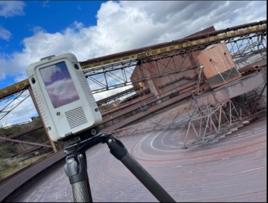
- 3D Laser Scanning
- Legal Land Surveying
- Line Cutting
- Mechanical Alignment
- Mineral Claim Lease Surveying
- Mineral Claim Staking
- Photogrammetric Services
- Pre-Engineering Surveying
- Quality Assistance
- Quality Control
- Real Property Reports
- Road Work Surveying Support
- Scanning Technology
- Settlement Monitoring
- Sub-Division Surveying
- Survey Supervision
- Title Record Research
- Topographic Surveying
- Underground Utility Locates
Interested in our services? We’re here to help!
We want to know your needs exactly so that we can provide the perfect solution. Let us know what you want and we’ll do our best to help.