
OUR PROJECTS
N.E. Parrott Surveys Limited provides services to both the private and public sectors across multiple industries. NEPSL utilizes modern surveying equipment in collecting field data; combined with our qualifications, software and training, we are able to offer our clients quality results and deliverables in an efficient and professional manner.
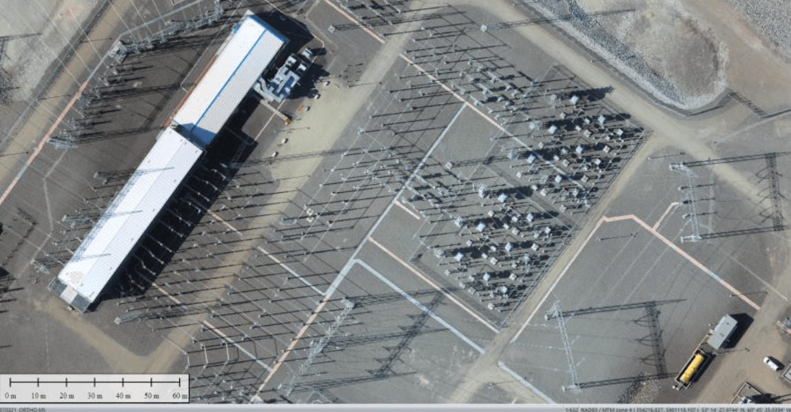
Iron Ore Company of Canada
Iron Ore Company of Canada
Labrador West, NL
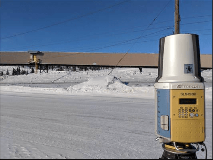
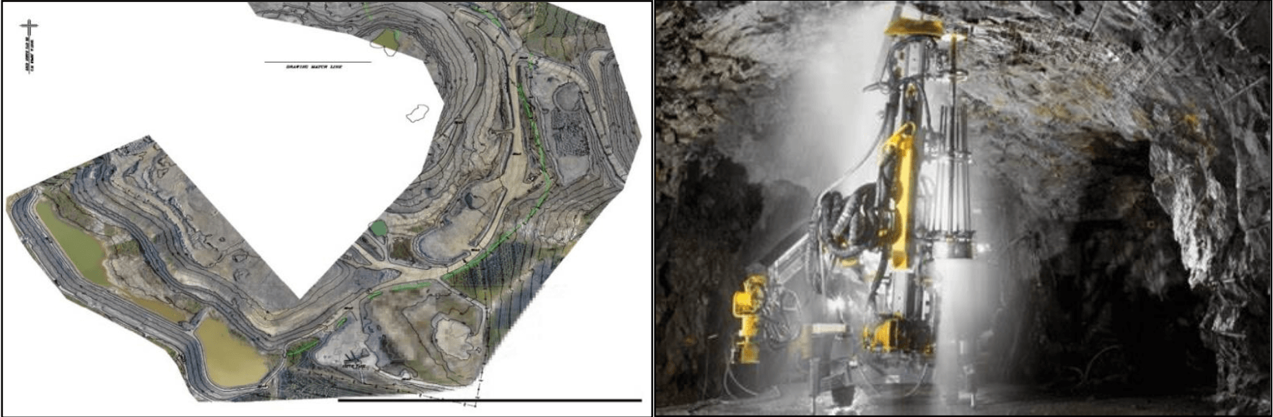
N.E. Parrott Surveys Limited has played a critical role in numerous high-impact projects at the Iron Ore Company of Canada (I.O.C.C.) mine site in Labrador West, providing comprehensive surveying, scanning, alignment, and geospatial services. Our contributions have directly supported operational efficiency, project execution, and infrastructure development.
Key Responsibilities Include:
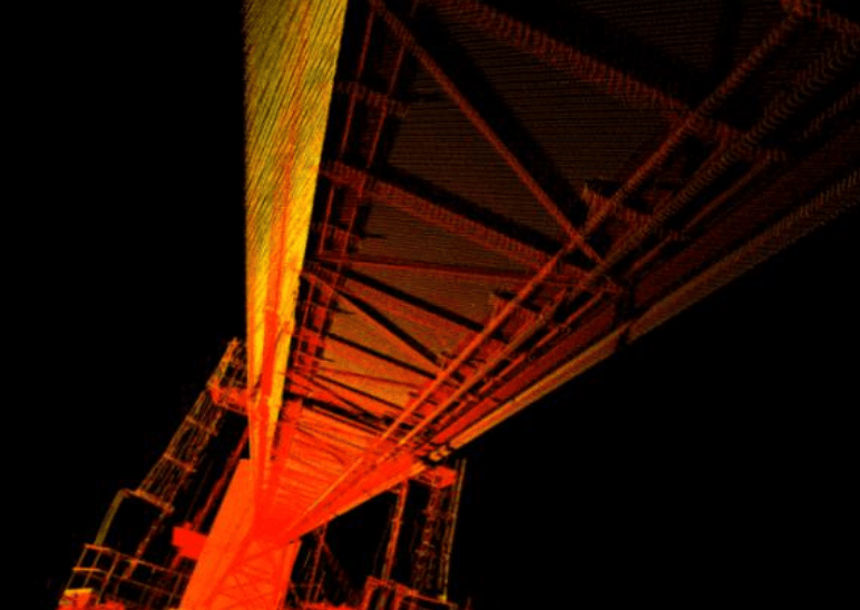
• Extensive 3D Scanning & Modelling Projects: Delivered large-scale scanning and modelling solutions for:
o Deformation monitoring
o Utility and infrastructure mapping
o Asset and facilities management
o Road furniture, pipelines, and Building Information Modelling (BIM)
o Structural analysis, volumetric studies, stockpile assessments, and as-built documentation
• Pocket Re-Builds: Survey and modelling support for critical infrastructure maintenance and restoration.
• Induration Machine Re-Builds: Precision scanning and alignment for refurbishment of key components, ensuring performance restoration and extended service life.
• Advanced RPAS / UAV Operations: Utilized UAV technologies for aerial surveys, inspections, and data acquisition in hard-to-access areas with increased safety and efficiency.
• Underground Utility Locates: Provided accurate subsurface mapping to reduce risk during excavation and construction.
• Mechanical Alignment: Conducted alignment of various mechanical systems including:
o Conveyors, pulleys, idlers, frames
o Drive shafts, motors, bearing pedestals
o Rails (including overhead crane rails)
o Shuttle systems
• Survey Support for Mega Expansion Project: Supplied ongoing QA survey services to ensure construction precision and adherence to engineering specifications during major development phases.
• Quantity Surveys: Performed scheduled volumetric assessments of stockpiles containing raw materials and finished product to support inventory and planning.
• Legal & Topographic Surveys: Executed various boundary, title, and terrain-based surveys to support operational and planning activities across Labrador West.
• G.P.S. Control and Real-Time Surveys: Conducted topographic and hydrographic surveys for proposed dyke systems, using GPS control networks and advanced survey instrumentation.
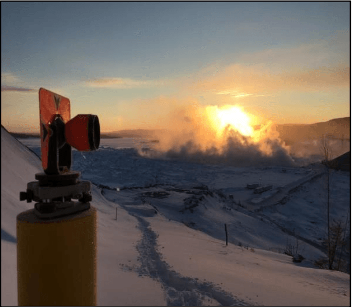
Schefferville Mining Belt
Schefferville Mining Belt
Schefferville, QC
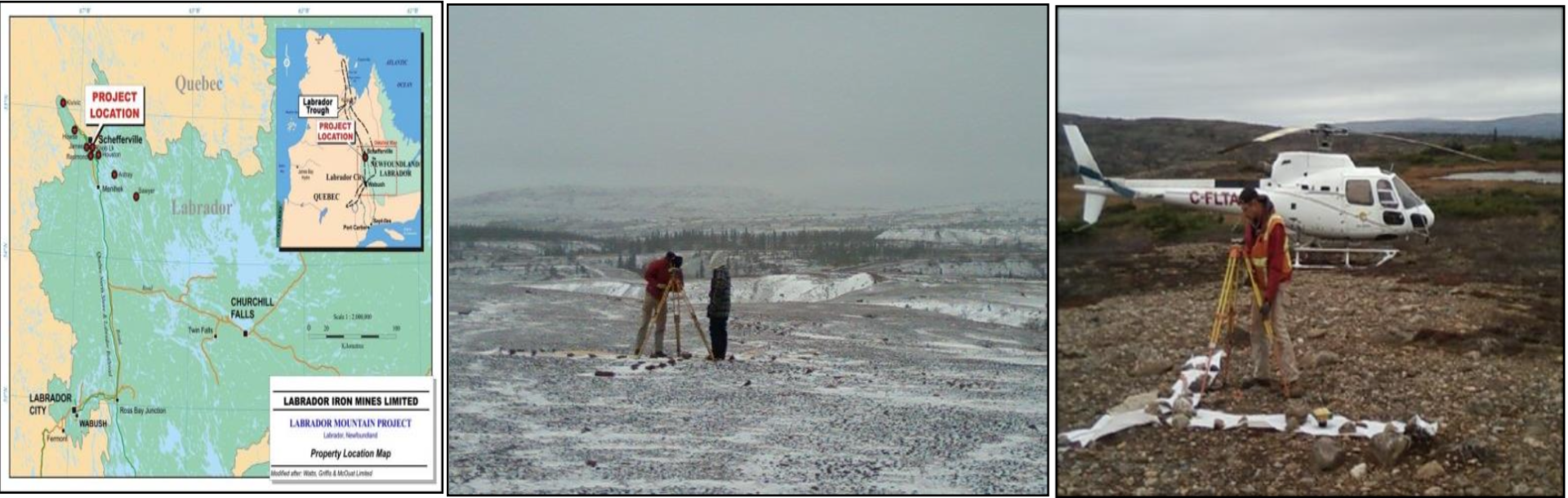
N.E. Parrott Surveys Limited is actively engaged in supporting major mining operations in the Schefferville region, delivering a wide range of surveying services essential for current and future development. Our contributions ensure precise spatial data, legal compliance, and readiness for expansion.
Key Responsibilities Include:
• Survey Support: Providing on-site survey services to assist in daily mining operations, site development, and infrastructure planning.
• Legal Surveys: Conducting boundary and title surveys in compliance with provincial and federal regulations to support land use, leasing, and property development.
• Topographic Surveys: Capturing accurate surface data to inform engineering design, site planning, and resource evaluation.
• GPS Control for Aerial Photography: Establishing ground control points to support aerial mapping initiatives and ensure spatial accuracy for lease planning and environmental assessments.
• Preparation of Leases for New Mining Development: Supplying survey data and documentation required to facilitate legal and regulatory approval processes for new mine sites.
Voisey Bay Nickel
Voisey Bay Nickel
Voisey Bay, NL
N.E. Parrott Surveys Limited (N.E.P.S.L.) played a critical role in the construction and continued development of the Voisey’s Bay Nickel Mine, providing a comprehensive suite of surveying and quality control services across all phases of the project.
Key Responsibilities Include:
• Construction Surveying & Quality Control: Oversaw quality assurance and provided precise survey work for the construction of mine infrastructure, including:
o Access roads
o Airstrip layout
o General site layout
o Relative and control surveys
o Verification and quality control of third-party survey activities
• Drill Hole Surveying: Established accurate azimuths and coordinates for numerous drill holes to support exploration and geotechnical investigations. This included:
o Borehole location surveys
o Hydrographic drill hole referencing in collaboration with Newfoundland Geosciences
• Control Network Expansion: Recently expanded and densified the site-wide control network to support:
o Aerial Photography Surveys for surface modelling
o Ongoing and future underground mine expansion initiatives
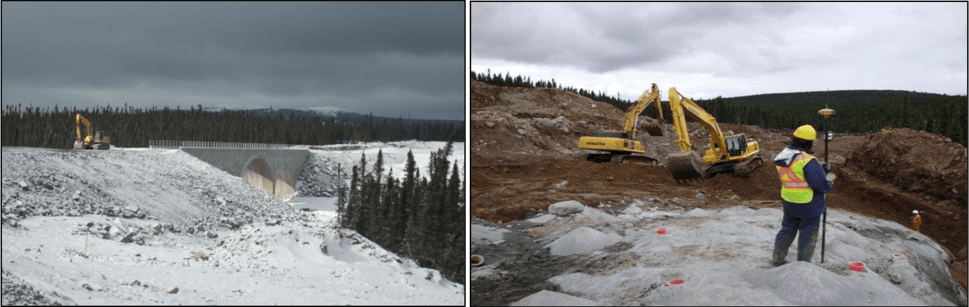
Lower Churchill Project
Lower Churchill Project
Happy Valley - Goose Bay, NL
Churchill Falls, NL
Churchill Falls, NL
N.E. Parrott Surveys Limited has been a key contributor to the Lower Churchill Development Project, delivering a wide range of specialized surveying services to support hydropower development, environmental planning, and infrastructure design. Our work has been integral in establishing critical geospatial data across vast and remote areas of Labrador.
Key Responsibilities Include:
• First-Order Control Network: Established a primary control network extending from Happy Valley–Goose Bay to Churchill Falls. This network was officially adopted by the Government of Newfoundland and Labrador for inclusion in the Provincial Control System.
• Hydrographic Surveys: Conducted detailed hydrographic surveys from the Churchill Falls tailrace to the mouth of the Churchill River into Lake Melville, supporting flow analysis and environmental impact studies.
• Topographic Surveys: Mapped terrain and riverbank areas along the Churchill River corridor for site development and floodplain modelling.
• Bridge Elevation Surveys: Determined elevation data for multiple bridges along the Trans-Labrador Highway, referenced to projected flood and reservoir water levels for engineering validation.
• Gull Island Project Support: Provided technical survey assistance for proposed hydroelectric development at Gull Island.
• Ice Flow Projection Support: Delivered surveying data to aid in modelling ice flow dynamics along the river system for safety and structural design.
• Atikonak Lake Surveys: Executed integrated GPS control, topographic, and hydrographic surveys at Atikonak Lake to support reservoir planning as part of the Lower Churchill initiative.
• Mechanical Alignment: Services for installation of key infrastructure such as gates, turbines and turbine liners.
Project’s Undertaken:
• Aerial Photography Survey: Ground control and spatial referencing for aerial mapping initiatives to support design and environmental assessment.
• Bathymetric Surveys: Depth and profile surveys of riverbeds, lakes, and reservoirs to inform hydrological modelling and infrastructure placement.
• Survey Control: Establishment of first-order survey control points integrated into the Provincial Control Network, ensuring consistent geodetic accuracy across project phases.
• Survey Support: Field survey services in support of engineering design, construction planning, and environmental studies.
• Topographic Surveys: Detailed surface mapping for infrastructure alignment, site selection, and flood risk assessment.
Bloom Lake Railway
Bloom Lake Railway
Labrador City, NL
N.E. Parrott Surveys Limited provided comprehensive surveying services for a major $108 million railway construction project, encompassing a 32-kilometre railway line. Our scope of work extended from initial land acquisition and legal support through to construction surveying, volume tracking, and final project closure.
Key Responsibilities Included:
• Survey Crew Deployment: Supplied multiple field crews throughout the construction schedule to ensure continuous and accurate survey support.
• Legal Survey & Land Acquisition: Conducted legal surveys and prepared lease documentation necessary for land acquisition along the proposed rail corridor.
• LiDAR Verification Survey: Verified LiDAR data for use in design validation, cut/fill analysis, and alignment optimization.
• Bulk Excavation & Volume Tracking: Performed excavation surveys to monitor quantities of material removed and ensure accurate progress reporting and material management.
• Material Layout Surveys: Conducted precise layout surveys following excavation to facilitate organized placement of structural and construction materials.
• Ballast & Track Layout: Assisted in layout of ballast beds and rail alignments, ensuring optimal positioning of track components for operational reliability.
• QA/QC Rail Leveling: Executed quality assurance and quality control elevation checks along the entire 32 km railway to meet engineering specifications and safety standards.
• Final Legal Survey: Delivered a comprehensive legal survey upon project completion, establishing final right-of-way boundaries and official land records.
Trans Labrador Highway
Trans Labrador Highway
Happy Valley - Goose Bay, NL Churchill Falls, NL
Labrador City, NL
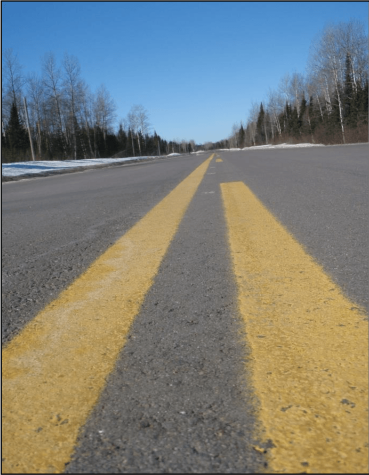
N.E. Parrott Surveys Limited (NEPSL) has played a significant role in the surveying and development of the Trans Labrador Highway (TLH), providing critical geospatial data and construction layout services over several phases of redesign, reconstruction, and infrastructure upgrades.
Key Responsibilities Included:
• Construction Survey Support – Route 500: Supplied dedicated survey crews to support the redesign and reconstruction of Route 500, covering major regional centres including Happy Valley–Goose Bay, Churchill Falls, and Labrador City.
• Surveying – Route 520 and Existing Highway Redesign: Completed surveying for:
o Four 50-kilometre segments of Route 520 from Cartwright to Happy Valley–Goose Bay (km 114 to km 165).
o 200 kilometres of existing Trans Labrador Highway to support route optimization and redesign initiatives.
• Fibre Optic Infrastructure Survey: Supplied survey crews for the installation of a 600-kilometre fibre optic pole line stretching from Happy Valley– Goose Bay to Labrador City, providing accurate placement and terrain mapping support.
• Comprehensive Topographic & Construction Layout Surveys:
o Conducted a full topographic survey of the Trans Labrador Highway corridor from Goose Bay to Labrador City, forming the basis of roadway redesign by Amec.
o Carried out construction layout surveys for:
Road shoulders
Granular class materials
Edge of asphalt
Centerline markings
Final as-built verification post-construction
• Survey Control Network Development: Established and maintained a high-accuracy control network along the highway corridor to ensure consistent geospatial reference across all phases of work.