Advanced RPAS / UAV Operations
N.E. Parrot Surveys Limited is a leader in advanced RPAS/UAV (Remotely Piloted Aircraft System/Unmanned Aerial Vehicle) operations. The company has extensive experience in providing high-accuracy survey services, offering precision in X, Y, and Z coordinates to within 3cm, with ground resolution of 2.9cm per pixel at 122m (400ft) AGL.
Key Projects:
N.E. Parrott Surveys Limited has undertaken a wide variety of projects, including:
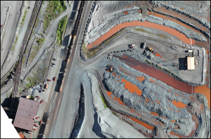
Aerial Survey of stockpiles to calculate Volumes.
· Aerial Survey of Stockpiles: Utilized for accurate volume calculations.
· Aerial Survey of Existing Gravel Roads: For pre-engineering purposes, aiding in upgrading roads to asphalt.
· Aerial Survey of Tailings Discharge: Pre-engineering surveys to assist with dyke system design and pipe advancement.
· Aerial Inspection of Apron Feeder Doghouse Installation: A safer and more efficient method for eliminating confined space inspections.
· Aerial Inspection of Apron Feeder Liners: Conducted inside ore storage areas for maintenance and operational insights.
· Quarry Management: Using aerial data to support the management and optimization of quarry operations.
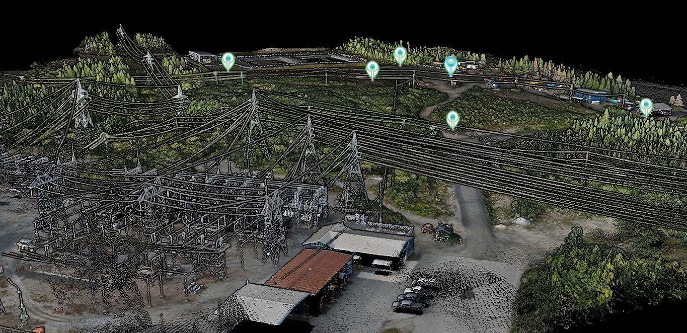
· Aerial Survey of Transmission Lines & Sub-stations: Conducted detailed aerial surveys of high-voltage transmission lines and sub-stations, focusing on vegetation clearance, calculating sag in the lines, and performing infra-red inspections of utilities. This service helps ensure safe operations, optimize vegetation management, and identify potential faults such as hotspots or weak spots in the infrastructure before they become critical issues.
Deliverables:
The company provides detailed and precise deliverables that include:
· Orthomosaic (Georeferenced): High-resolution, accurate image stitching, mapped to real-world coordinates.
· Point Cloud and Mesh: 3D data models for further analysis and design.
· DSM (Digital Surface Model), DTM (Digital Terrain Model), and Index: Detailed terrain and surface information for engineering and environmental assessments.
· Contour Lines: Generated from Raster DSM/DTM data, useful for site planning and design.
· Volume Calculations: Accurate measurements for stockpiles, excavations.